
Overview
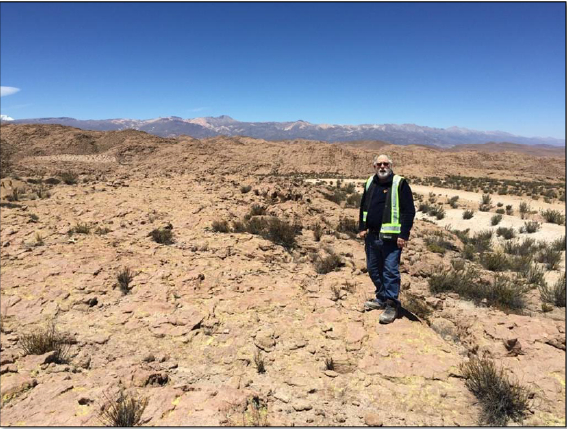
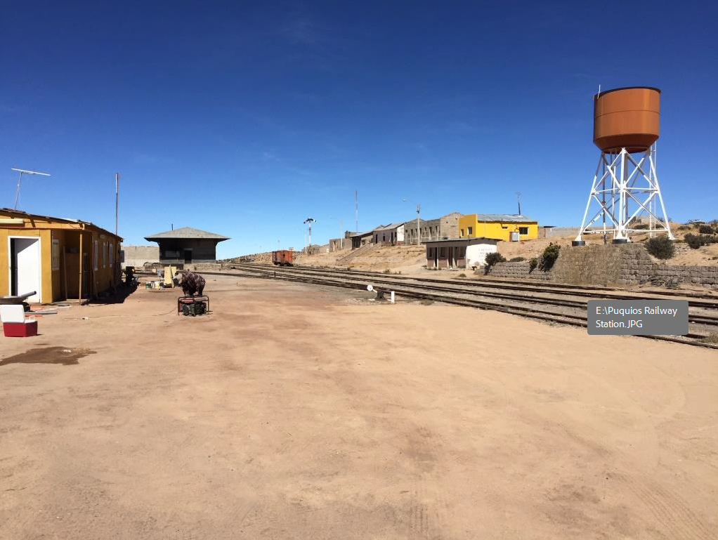
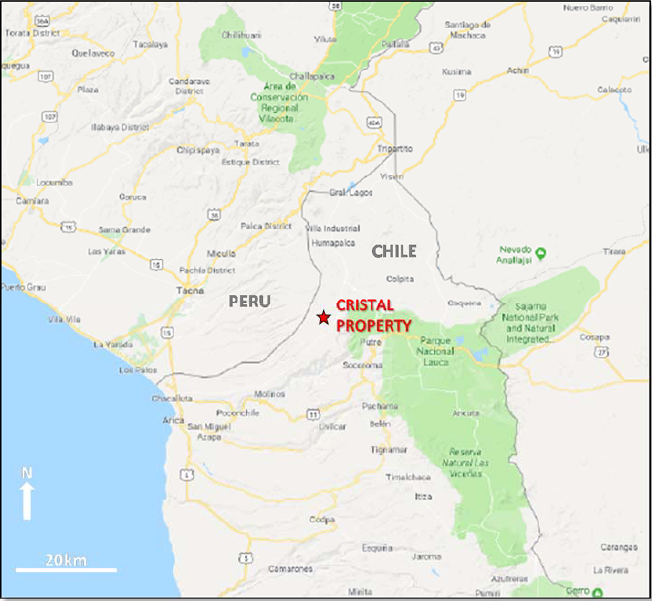
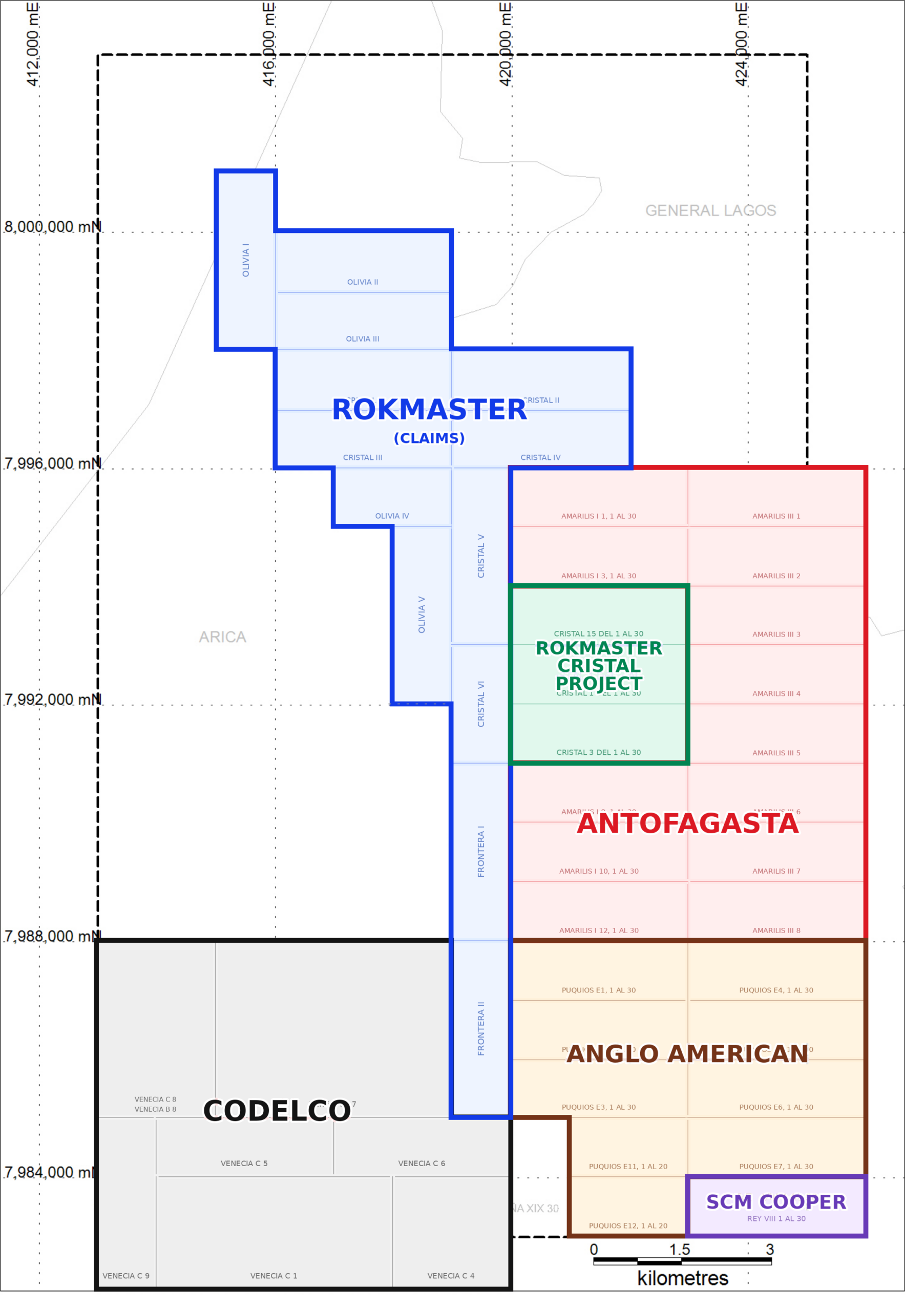
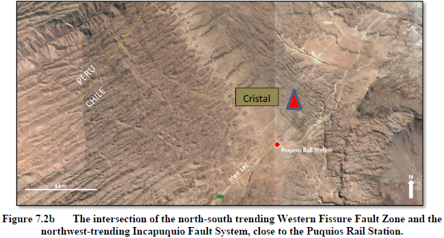
In July 2026, Rokmaster Resources signed an option to acquire 100% of the Cristal Porphyry Copper Project which consists of 3 Mensuras (exploitation licenses) totalling 9 km² in the Western Andes region of Northern Chile. Located ~10kms south of the border with Peru within the Huayillas Quadrangle Cristal is situated ~72kms (1:15mins) via highway 135 from the Chilean coastal city of Arica. Cristal benefits from excellent local infrastructure including rail access through the Puquios rail station and nearby hydro power. Cristal is characterized as an exploration project which doesn’t require drill permits and enjoys unrestricted access as the surface rights are held by the Chilean government.
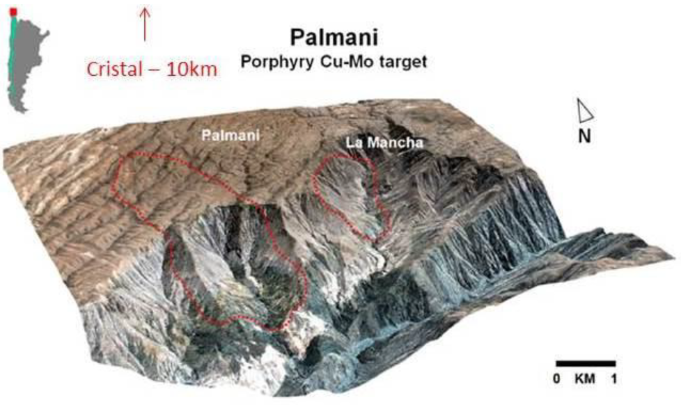
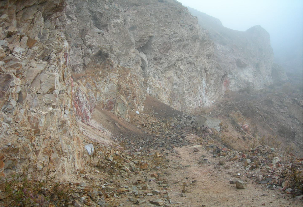
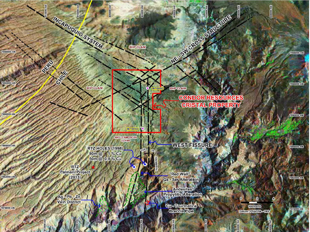
Cristal, located in a favourable geological region, is situated near the intersection of the prolific NW-trending Incapuquio Fault and the NS-trending West Fissure Fault Zone, a highly prospective regional structural corridor associated with large copper deposits in Chile and Peru. Several strands of the west fissure fault zone, believed related to mineralization at several copper deposits in northern Chile, trend through the Cristal Project area. 10kms south of the Cristal Porphyry Copper Project lies the Rio Lluta Property and the Quebrada Palmani porphyry copper target which provides potentially valid evidence for deep-seated copper mineralization underlying Cristal. Of note, within the Rio Lluta area, on the east side of the Quebrada Palmani target, is a famous outcrop known as the “Red Wall”. Though not part of the current Cristal property, both the Rio Lluta Project and the Red Wall provide significant evidence for copper mineralization in the region.
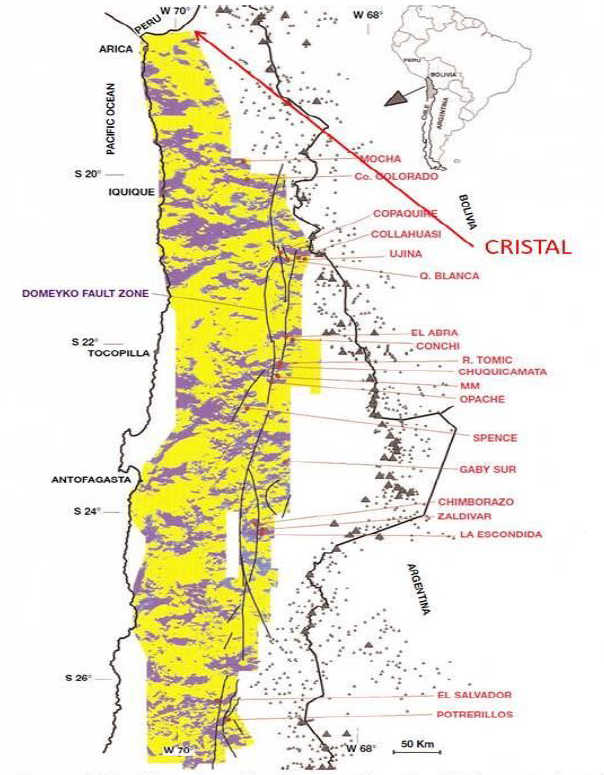
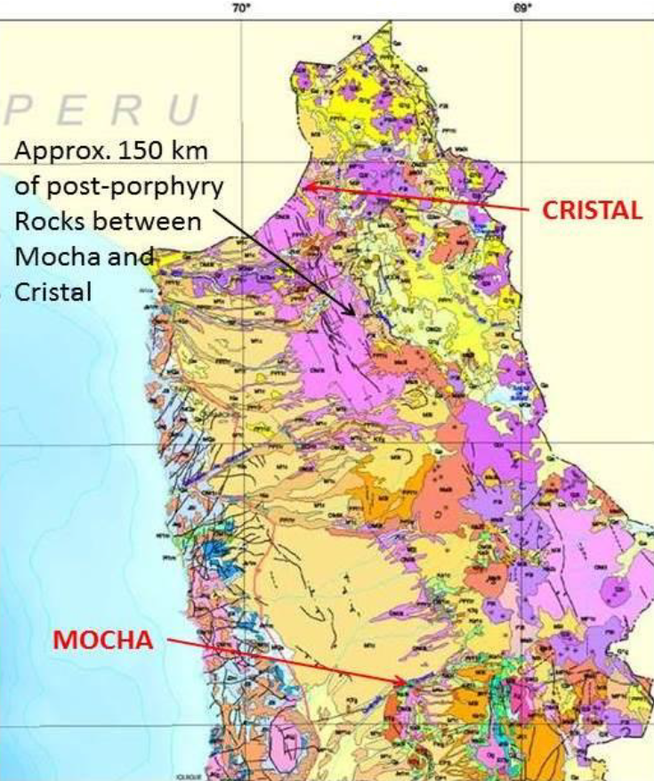
Further south of the Cristal Project, approximately 150kms, is the Mocha porphyry copper deposit, the last recognized deposit going north in Chile which is dominated by younger volcanic cover rocks possibly providing evidence of a buried porphyry deposit at Cristal. Additional evidence of a potential blind porphyry copper deposit at the Cristal Project is seen in the results of exploration activities at the “Expanded” Cristal Project and adjacent properties by the likes of BHP, Rio Tinto, Peregrine Metals, Princeton Metals, and others betweeen 1990-2014. From 2012-2014, BHP spent >$2M in exploration activities consisting of Airborne Geophysical Surverys and 1,626m of drilling covering all the expanded Cristal Project.
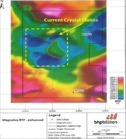
The findings of the exploration activities include: (a) Princeton Mining in 1993 drilling its Rio Lluta Project (10kms south of Cristal) and intersecting a distal portion of a porphyry system with the best porphyry potential interpreted to be north in the area of the Cristal project; (b) drilling by Rio Tinto from 1997-1998 at its nearby Lamancha Property returning .42% copper over 3.0m exhibiting incipient chalcocite and strong phyllic to potassic alteration; (c) in 2012 BHP conducted airborne geophysical surveys (magnetic, gravity, electromagnetic) at the expanded Cristal Property showing a circular, donut-shaped anomaly 3kms in diameter, exhibiting a weak mag-high in the centre surrounded by a mag-low, and interpreted to potentially be a response to a buried porphyry copper deposit; (d) BHP interpretation of electromagnetic data suggests a NW-trending topographic ridge underlying younger volcanic cover rocks ~600m deep; (e) 1,626m of drilling by BHP in 2013 confimed EM data of a buried ridge ~600m below surface.
Historical Work (Overview)
“Expanded” Cristal Project & Area – Work Completed:
- 1990’s – Regional exploration by various companies along the West Fissure Fault Zone from Escondida Mine (BHP) to Chuquicamata Mine (Codelco) to Chile border w/ Peru
- 1993 – Princeton Mining – 11 Rotary Drill Holes at its Rio Lluta Project south of the current Cristal property
- 1997-1998 – Rio Tinto – Drilled 5 holes at La Mancha Property to the north of Princeton’s Rio Lluta Property
- 2006 – Condor Resources/Peregrine Metals – Deep penetrating IP survey on southern portion of “expanded” Cristal Property (46 km²)
- 2012-2014 – BHP (>$2M in exploration expenditures from 2012-2014 ):
- 2012 – Airborne Geophysical Surveys (Airborne Magnetics, Gravity, Electromagnetic Geophysics) covering all of the “expanded” Cristal Property
- 2013 – 2 drill holes, total of 1,626m, in close proximity to current Cristal Property
- Drill Hole INT003D:
- 905m deep
- 3 kms south of current project area at “expanded” Cristal Property
- Drill Hole INT005D:
- 721m deep
- 1 km north of current project area on “expanded” Cristal Property
- Drill Hole INT003D:
- 2013 – Rio Tinto – Drilling at nearby land claims
Results/Findings:
- 1993 – Princeton Mining:
- Intersected what is believed to be the distal portion of a porphyry system
- Abundant disseminated pyrite and epidote-chlorite propylitic alteration encountered in most drill holes
- One hole grading 0.12% copper over 10.5m, One hole grading 0.2% copper over 3.0m
- Best porphyry potential was interpreted to be north in the vicinity the of current Cristal property
- 1997-1998 – Rio Tinto
- Best of 5 holes returned 36m of 0.42% copper
- Exhibited incipient chalcocite, and strong phyllic to potassic alteration
- Confirmed higher-grade copper mineralization exists in the district
- Suggests proximity to a porphyry center at depth
- 2012-2014 – BHP
- 2012 – Airborne Geophysical Surveys (Airborne Magnetics, Gravity, Electromagnetic Geophysics)
- shows a circular doughnut shaped anomaly, 3kms diameter, on the reduced-to-pole (“RTP”) image
- exhibits a weak magnetic high in the center, surrounded by a magnetic low
- interpreted to potentially be a response to a buried porphyry copper deposit
- BHP-interpreted EM data suggests a northwest-trending topographic ridge underlying the younger volcanic cover rocks
- 2013 – Drill Hole INT003D:
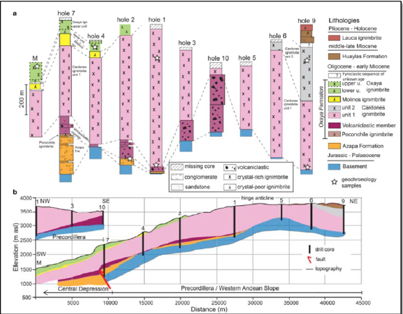
- Intersected post-mineral ignimbrites and conglomerates to 607m before intersecting the basement andesites of Cretaceous age at 905m
- Andesites contain local elevated pyrite (2-3%) but generally contain about 0.5% pyrite, with traces of chalcopyrite observed
- Provides confirmation of a buried porphyry copper target
- 2013 – Drill Hole INT005D:
- Intersected post-mineral ignimbrite to 430m, then basement intrusive quartz monzodiorite to final depth at 720.85m
- Quartz monzodiorite is similar to what’s exposed in the Rio Lluta valley, 10km to the south
- Intrusive characterized by weak chloritic alteration which contains local weak chalcopyrite, molybdenite, and magnetite in fractures
- Confirms a buried intrusive system at ~600m depth
- 2012 – Airborne Geophysical Surveys (Airborne Magnetics, Gravity, Electromagnetic Geophysics)
Geological Conclusions:
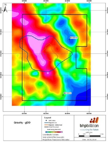
- Cristal displays coincident magnetic and gravity anomalies characteristic of major porphyry copper systems
- Abundant structural and geophysical evidence indicates a buried porphyry deposit at the Cristal Project ~600-800+m in depth
- Most major recent copper discoveries in the region have been buried porphyry systems
- BHP exploration & drilling on adjacent properties validates and supports the exploration model at the Cristal Project
Cristal Porphyry Copper Project Maps
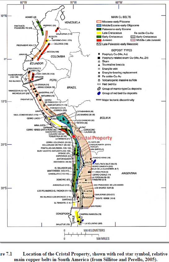
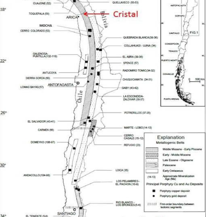
Photo Gallery